Realty Executives of Northern Arizona
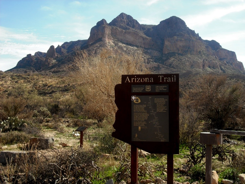
The Arizona National Scenic Trail is a National Scenic Trail from Mexico to Utah that traverses the whole north–south length of the state of Arizona. The 800-mile (1,300 km) long Arizona Trail was completed on December 16, 2011. The trail is designed as a primitive trail for hiking, equestrians, mountain biking, and even cross country skiing, showcasing the wide variety of mountain ranges and ecosystems of Arizona.
The idea for the trail was originally developed and promoted in 1985 by Dale Shewalter, a Flagstaff, Arizona, teacher. The Arizona Trail was designated as a National Scenic Trail on March 30, 2009 by the Omnibus Public Land Management Act of 2009. It forms part of the shortened version of the 6,875-mile (11,064 km) Great Western Loop. This version includes the Grand Canyon National Park.
By popular demand, the Arizona Trail Day Hiker’s Guide was created for people who are interested in hiking the Arizona Trail in smaller pieces. If you follow the recommendations in this guide you can complete the entire 800 miles in 89 day hikes ranging from 3.8 miles to 13.8 miles in length, with an average distance of around 9 miles per hike. Compiled by AZT thru-hiker Jake Baechle, the Arizona Trail Day Hiker’s Guide is available as a free digital download for ATA members.
Printed versions are available for $33 through the ATA Store.
(Photo credit: By Sonoradocent - Own work, CC BY-SA 4.0, https://commons.wikimedia.org/w/index.php?curid=49019335)
The vision of the Arizona Trail includes:
@aztassociation
THE ARIZONA TRAIL ON GOOGLE EARTH
You can download a file containing all of the current Arizona Trail GPS data in a format that is displayable on Google Earth. If you are not familiar with Google Earth, you can go to the Google Earth download page to learn about it and download the FREE software. Once you have this software installed, or if you already have it, click on the link below to download the Google Earth/Arizona Trail data file. Save this file on your computer and then open it using Google Earth.
Download the Arizona Trail Google Earth KMZ File
This can be viewed in Google map Apps and imported into any map within the Avenza Maps App.
Where the Experts are - Serving Flagstaff and Northern Arizona since 1977
 |
|